France
Collection
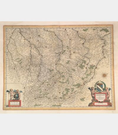
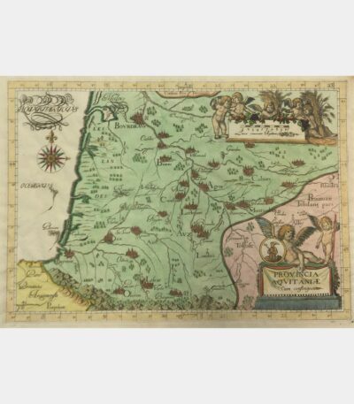
Latin Champagne Campania, Comitatus
180 €Latin Champagne Campania, Comitatus. Blaeu (Johann). 17th century.
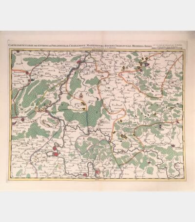
Special map of the area around...
180 €Special map of the area around Philippeville, Charlemont, Marienbourg, Rocroy, Charleville, Mezieres, Sedan. Covens (Johannes), Mortier (Cornelis). 18th century.
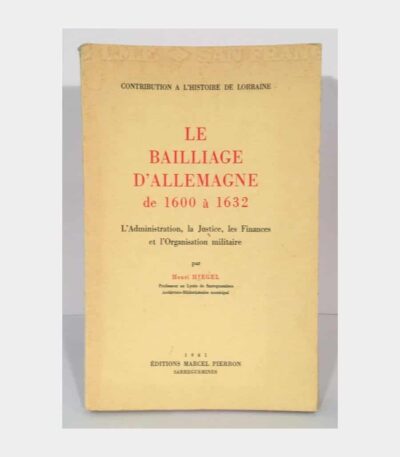
The Bailiwick of Germany from 1600...
60 €The Bailliage of Germany from 1600 to 1632. Administration, Justice, Finances and Military Organization. Hiegel (Henri). 1961.
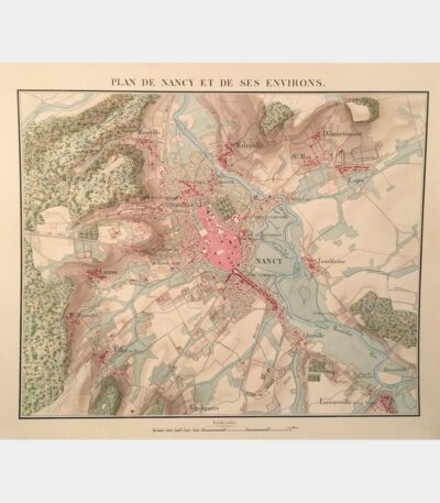
Map of Nancy and its surroundings....
800 €Nancy and the surrounding area. Manuscript map. Circa 1840.
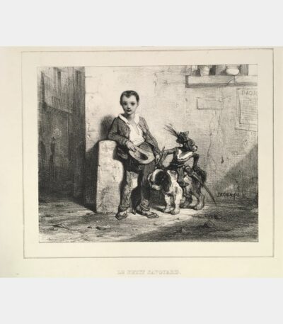
Le Petit Savoyard
60 €Le Petit Savoyard. Decamps (Gabriel Alexandre). Original lithograph. 19th century.
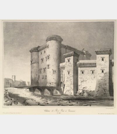
Château du Roi René in Tarascon
110 €Château du Roi René in Tarascon. Lithograph by Auguste Mathieu after Guesdon. 19th century.
Notre-Dame-des-Doms, view from the Promenade du...
110 €Notre-Dame-des-Doms, view from the Promenade du Rocher (Avignon). Rivière (Ch.). 19th century
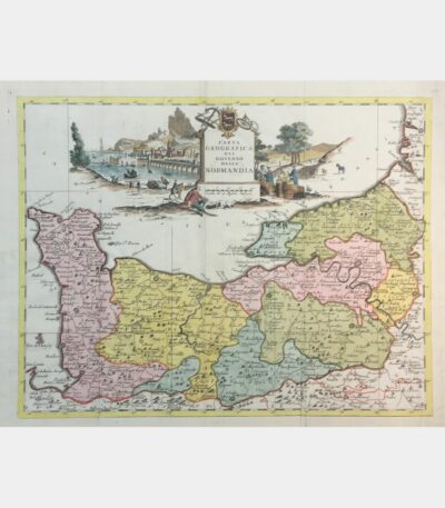
Carta geografica del governo della Normandia
160 €Carta geografica del governo della Normandia. De L’Isle (Guillaume). 1750.
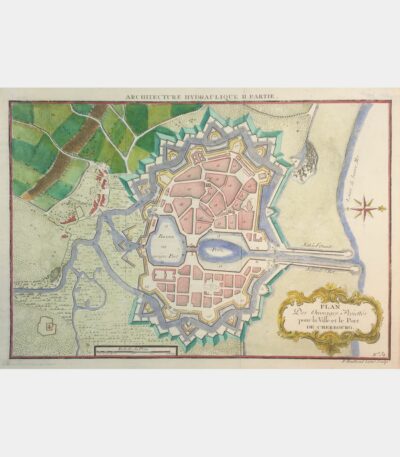
Plan Des Ouvrages Projettés pour la...
45 €Plan Des Ouvrages Projettés pour la Ville et le Port de Cherbourg. 18th century.
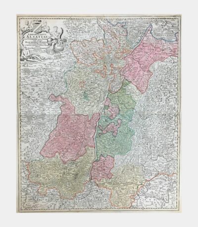
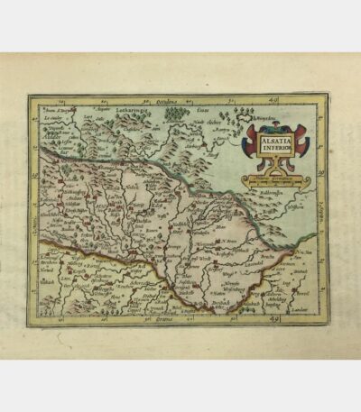
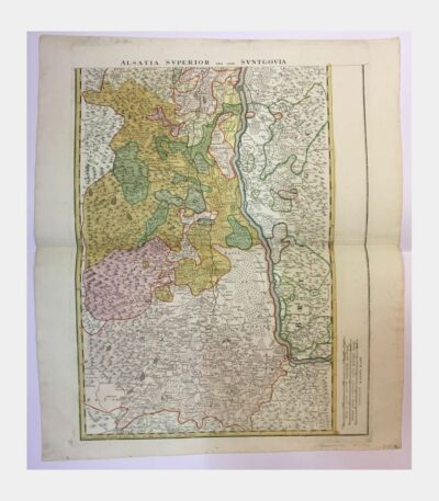
Landgraviatus Alsatiae tam Superioris quam Inferi(oris)...
230 €Landgraviatus Alsatiae tam Superioris quam Inferi(oris) cum utroque Marchionatu Badensi. 1720. Edited by Homann in Gutenberg. Copper engraving.
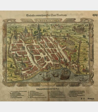
Bordeaux seen from the Cénon coast
100 €Bordeaux, view from the Cénon coast, Original etching by Maxime Lalanne, 19th century
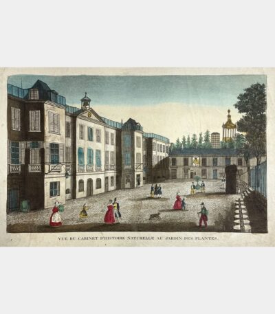
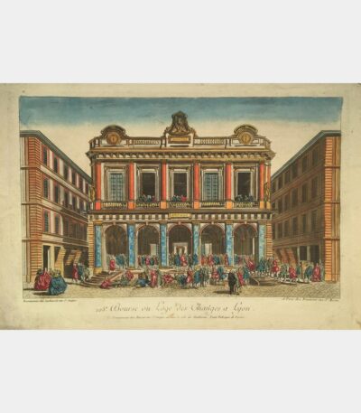
[Paris] Vue du Cabinet d’Histoire naturelle...
[Paris] Vue du Cabinet d’Histoire naturelle au Jardin des Plantes. Gravure sur cuivre. XVIIIème siècle.
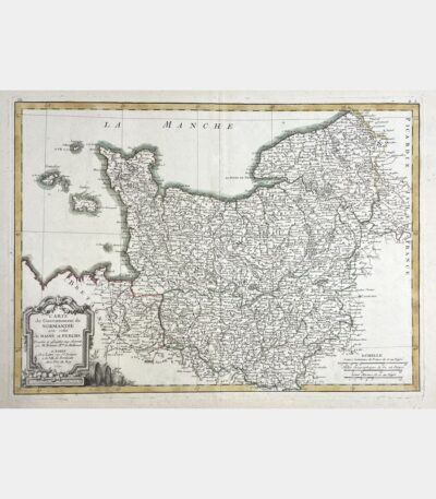
Map of the Government of Normandy...
Map of the Government of Normandy with that of Maine and Perche. Rigobert Bonne. 18th century.
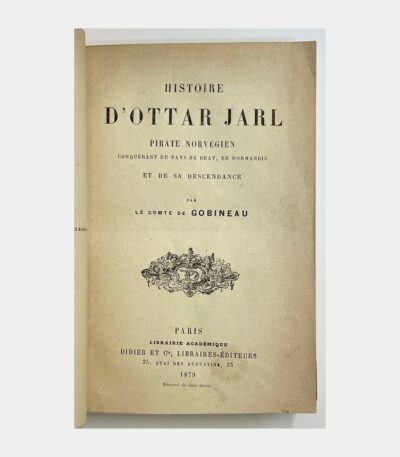
History of Ottar Jarl. Norwegian pirate...
History of Ottar Jarl. Norwegian pirate conqueror of the Pays de Bray in Normandy and his descendants. GOBINEAU (Arthur, Comte de). 1879.
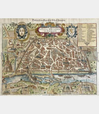
Portrait or Map of the City...
Portrait or Plan of the City of Auxerre. François de Belleforest. 1575.
The Charentais landscape in the works...
The Charentais landscape in the works of Eugène Fromentin and Pierre Loti. Selected pages with commentary and illustrations by Louis Suire. Louis Suire. 1946.
Customs of the Rosemont Valley
Customs of the Rosemont valley. Bonvalot (Edouard). 1866.
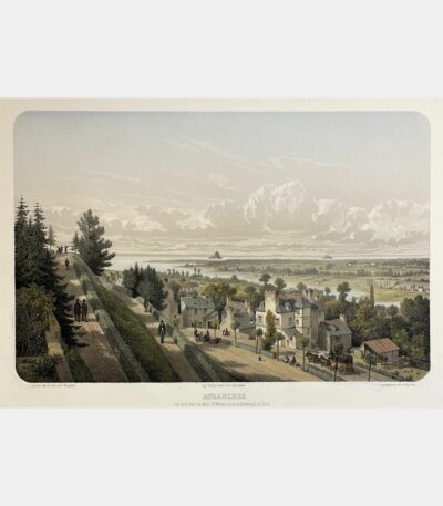
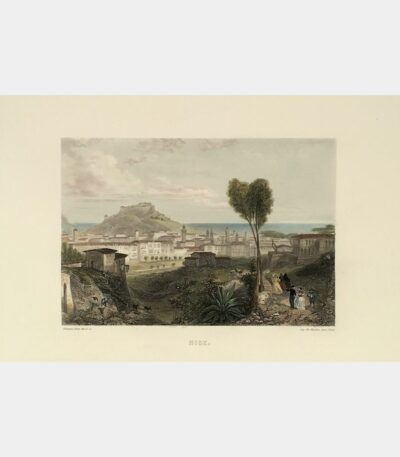
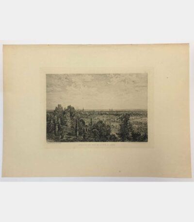
Avranches. View of the Bay of...
Avranches. View of the Bay of Mont-Saint-Michel, taken from Boulevard du Nord. Adolphe Maugendre. 19th century.
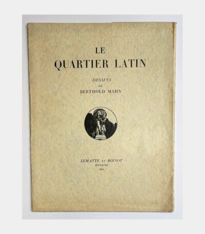
Le Quartier Latin. Dessins de Berthold...
Le Quartier Latin. Dessins de Berthold Mahn.,Lematte et Boinot, 1934; illustrated printed folio folder with 10 reproductions of Berthold Mann’s drawings of the Latin Quarter. Some foxing to dust jacket, spine weakened. One of 200 numbered copies on Japon de la Manufacture Impériale (n°138),Le Quartier Latin. Drawings by Berthold Mahn. Berthold Mahn. 1934,Paris,quartier Latin,Berthold Mahn,imagier,Panthéon,musée de Cluny,Berthold Mahn,Lematte et Boinot,Berthold Mahn,Le Quartier Latin. Drawings by Berthold Mahn,687.jpg,Lematte et Boinot,687_2.jpg,1934; printed illustrated filled folio folder containing 10 serpente reproductions of Berthold Mann’s drawings of the Latin Quarter. Some foxing to dust jacket. Berthold Mahn. 1934.
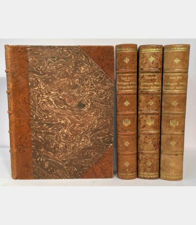
Verklingende Weisen. Lothringer Volkslieder.
Verklingende Weisen. Lothringer Volkslieder. Pinck (Louis). Henri Bacher. 1926 – 1939.
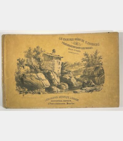
Le carton inédit de V. Fagonde...
Lithographed album of the Vosges. Fagonde (Victor). 19th century.
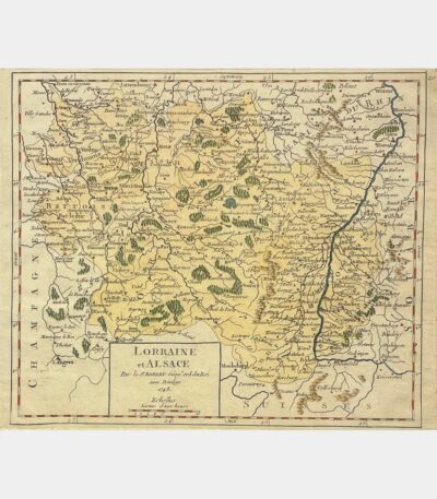
Lorraine and Alsace
Lorraine and Alsace. Gilles Robert de Vaugondy. 1748
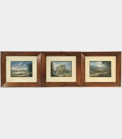
Three views of Niederbronn and the...
Three views of Niederbronn and the surrounding area. View of the Niederbronn baths. The pond at Niederbronn. Ruin of the Wasenbourg. Anonymous. Nineteenth century.
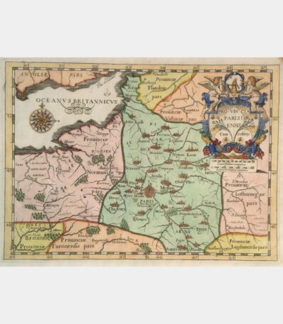
Provincia Parisiensis cum cofiniis
Provincia Parisiensis cum cofiniis. Copper engraving. 1654.
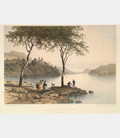
Châtillon and Lac du Bourget
Châtillon and Lac du Bourget. Lithograph by Eugène Ciceri. 1864.
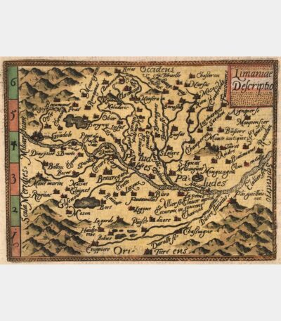
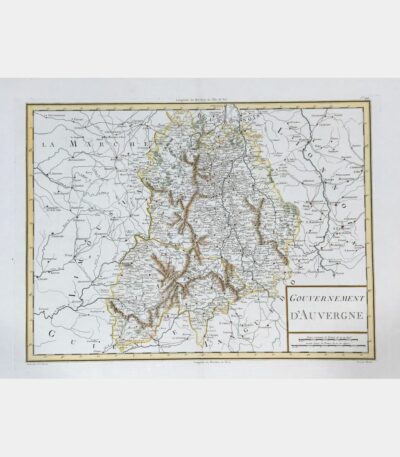
Limaniae Descriptio – map of Limagne,...
Limaniae Descriptio – map of Auvergne. Ortelius (Abraham). 1583
Monographie de la cathédrale de Nancy...
Monographie de la cathédrale de Nancy depuis sa formation jusqu’à l’époque actuelle. Auguin (Edgard). 1882.
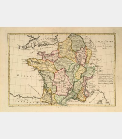
Map of France – Gallia Vetus
Map of France – Gallia Vetus. Bonne (Rigobert). 18th century.
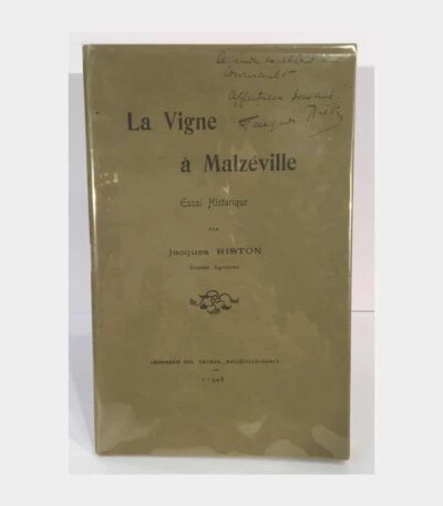
The vine in Malzéville. A historical...
The vine in Malzéville. A historical essay. Riston (Jacques). 1908.
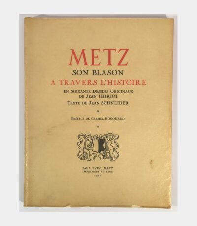
Metz. Its coat of arms through...
Metz. Its coat of arms through history. Schneider (Jean). 1951.
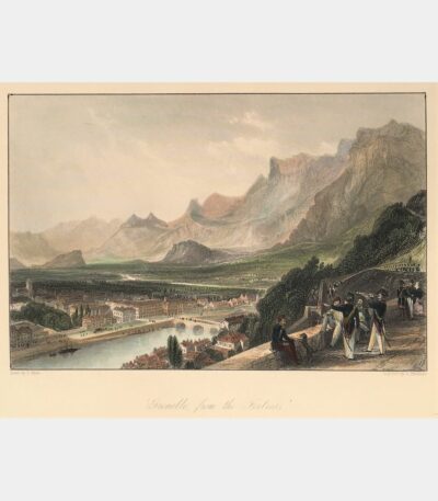
Grenoble from the Bastille
Grenoble from the Bastille. Steel engraving. 19th century.
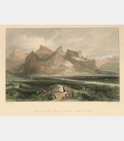
Grande Chartreuse mountain, from Grenoble
Grande Chartreuse mountain, from Grenoble. Steel engraving. 19th century.
Collection des principaux Monumens et Vues...
Collection des principaux Monumens et Vues de Paris. 1836.