Geography and travel
Collection
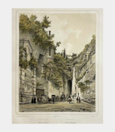
Naples – Pozzuoli Cave
160 €Naples – Grotte de Pouzzole. Lithograph by Louis-Julien Jacottet after Philippe Benoist. Circa 1850.
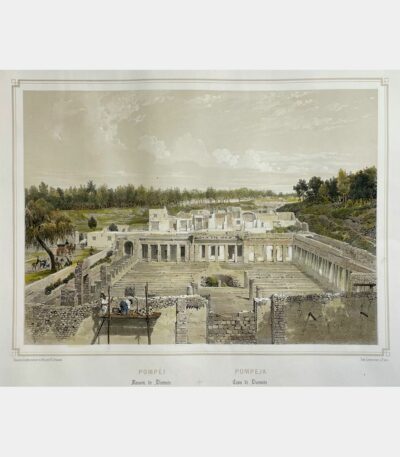
Pompeii – House of Diomedes
120 €Pompeii – House of Diomedes. Original lithograph by Philippe Benoist. Circa 1850.
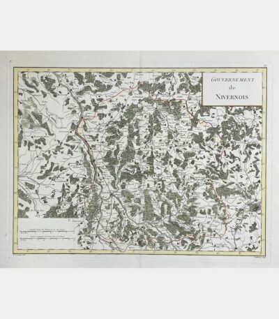
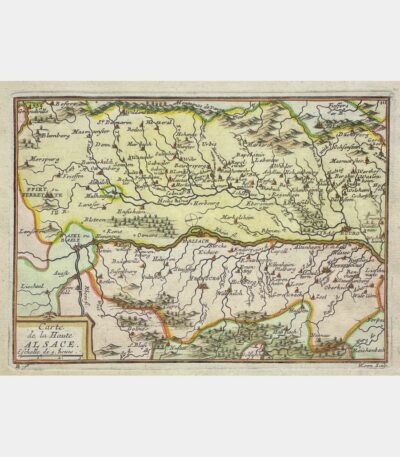
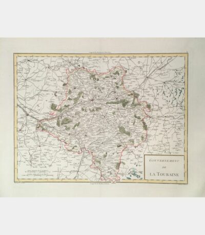
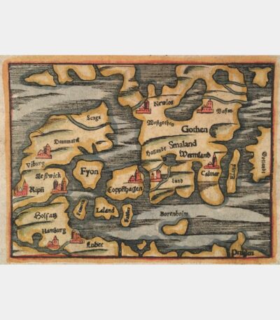
Northern part of the general government...
180 €Septentrional part of the general government of Burgundy. Gilles Robert de Vaugondy. 1748
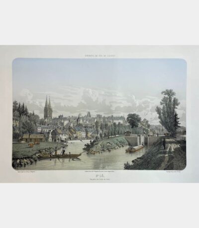
Saint Lô, view from the banks...
180 €Saint Lô, view from the banks of the Canal. Adolphe Maugendre. Circa 1850.
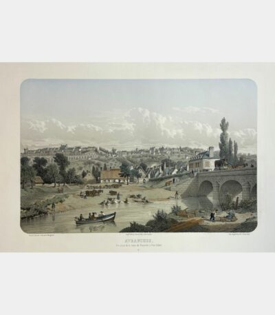
Avranches, view from the Granville road...
180 €Avranches, view from the Granville road at Pont-Gilbert. Adolphe Maugendre. Circa 1850.
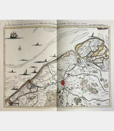
Particular map of the area around...
280 €Particular map of the area around Bruges, Ostend, Damme, L’Ecluse and others. Johannes Covens and Cornelis Mortier. 1745.
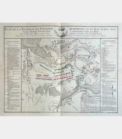
Plan of the battle of Fontenoy...
110 €Plan de la bataille de Fontenoy remportée le XI may M.DCC.XLV par l’armée françoise. Jean de Beaurain. 18th century.
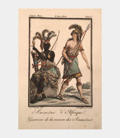
Amazone d’Afrique, Guerriere de la riviere...
50 €Amazone d’Afrique, Guerriere de la riviere des Amazônes. Etching and aquatint by Louis-Laurent-Pierre Lachaussée. 1806.
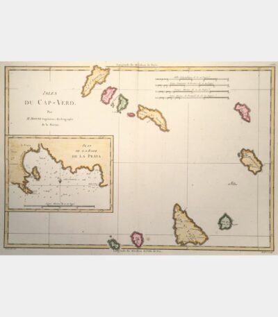
Cape Verde Islands. Plan of La...
90 €Cape Verde Islands. Plan of La Praya roadstead. Rigobert Bonne. 18th century.
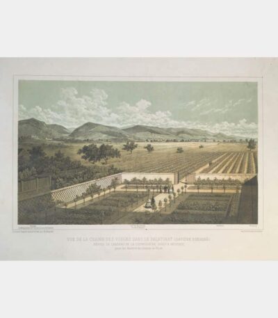
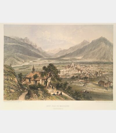
View of the Vosges mountain range...
120 €View of the Vosges mountain range in the Palatinate (Rhineland Bavaria) from Ludwigshöhe Castle to Neustadt, taken from the windows of Rhodt Castle. Lithograph by Charles Hancké. Nineteenth century.
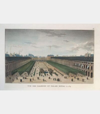
View of the Palais Royal galleries...
50 €View of the Palais Royal galleries in 1789. Aquatint. Nineteenth century.
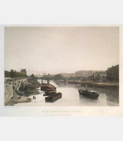
View of the Seine and the...
180 €View of the Seine and Solferino Bridge from the Pont de la Concorde. Original lithograph by Philippe Benoist. 1861
Topographical and geognostical description of the...
130 €Topographical and geognostical description of the Kaiserstuhl. Eisenlohr (Otto). 1838.
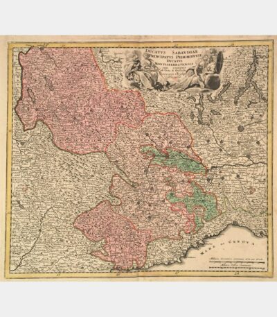
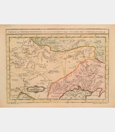
Ducatus Sabaudiae Principatus Pedemontii Ducatus Montisferratensis
150 €Ducatus Sabaudiae Principatus Pedemontii Ducatus Montisferratensis. Christoph Weigel. 18th century.

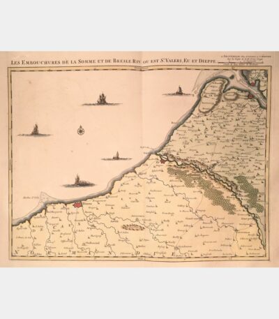
Mouths of the Somme and Bresle...
240 €The mouths of the Somme and Bresle Riv. or is St. Valeri, Eu and Dieppe. Amsterdam, J. Covens & C. Mortier. 18th century.
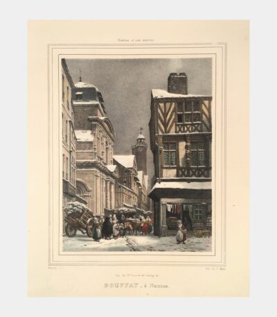
View of Sainte Croix and the...
80 €View of Sainte Croix and the Bouffay clock, Nantes. Lithograph by Motte. 19th century.
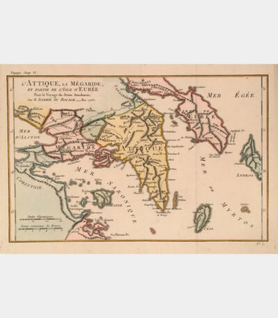
Attica, Megaraide and part of the...
55 €Attica, Megaraide, and part of the island of Evia. Jean-Denis Barbié du Bocage. 18th century.
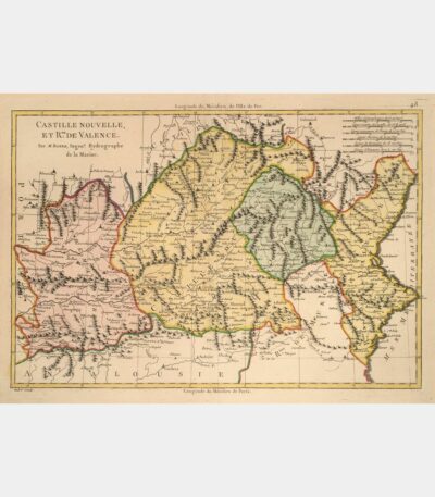
Castille Nouvelle et Royaume de Valence
70 €New Castile and Kingdom of Valencia. Rigobert Bonne. 18th century.
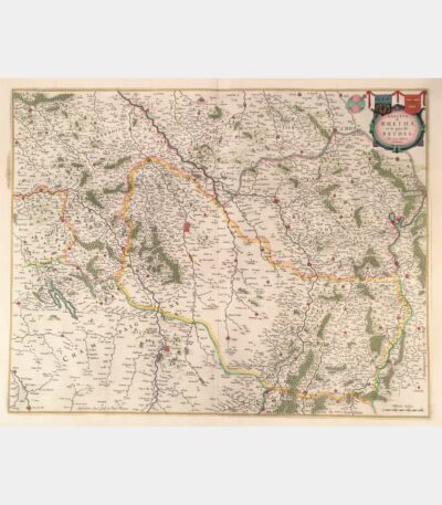
Diocese of Rheims and the country...
190 €Diocese of Rheims and the country of Rethel. Joan Blaeu. 1663.
Topographical and medical history of the...
110 €Topographical and medical history of the Grand Hotel-Dieu of Lyon. Pointe (Jacques-Pierre). 1842.
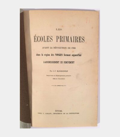
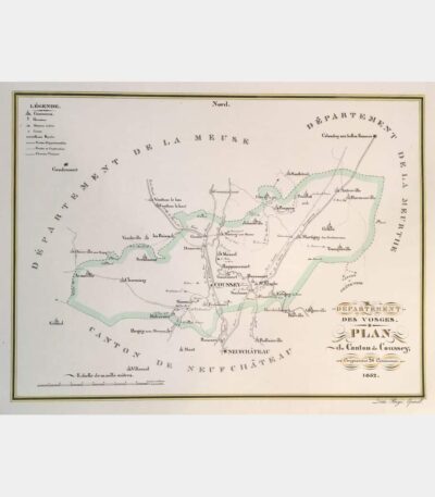
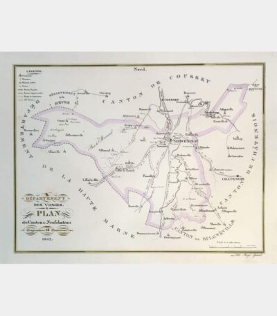
Primary schools before the Revolution of...
60 €Les Ecoles primaires avant la Révolution de 1789 dans la région des Vosges(… ). Mangeonjean (J. – F). (1874).
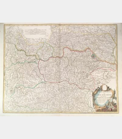
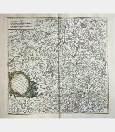
Northern part of the circle of...
120 €Northern part of the circle of Austria, comprising the Archduchy of Austria divided into its eight quarters and the upper part of the Duchy of Stiria. Didier Robert de Vaugondy. Circa 1800.
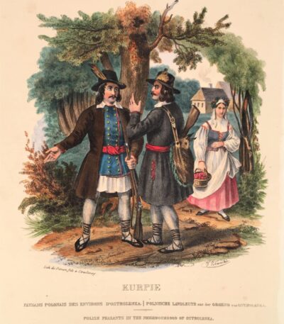
Polish peasants near Ostrolenka
60 €Polish peasants near Ostrolenka. Lithograph by Frédéric Simon after Lewicki. 1841.
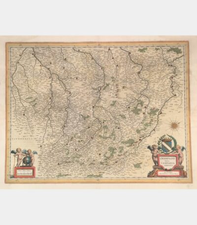
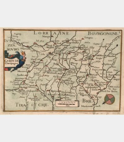
Latin Champagne Campania, Comitatus
180 €Latin Champagne Campania, Comitatus. Blaeu (Johann). 17th century.
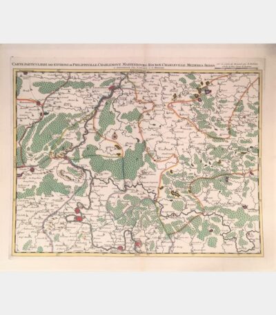
Special map of the area around...
180 €Special map of the area around Philippeville, Charlemont, Marienbourg, Rocroy, Charleville, Mezieres, Sedan. Covens (Johannes), Mortier (Cornelis). 18th century.
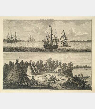
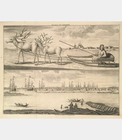
Samoiedes sleigh. Workcamps outside Archangel.
90 €Samoiedes sleigh. Shipyards outside Archangel. 1718.
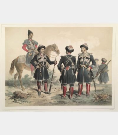
Uniforms of circus troops serving Russia
80 €Uniforms of the Circassian troops serving Russia. Lithograph by Adolphe-Jean-Baptiste Bayot after Ch. Giraud. 1852.
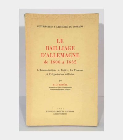
The Bailiwick of Germany from 1600...
60 €The Bailliage of Germany from 1600 to 1632. Administration, Justice, Finances and Military Organization. Hiegel (Henri). 1961.