
Cartography and travel
Collection


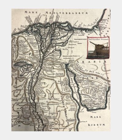
Egypten nach dem Zustand der alten...
200 €Egypten nach dem Zustand der alten Zeit vorgestellt. Copper engraving by S. Dorn. 1730.
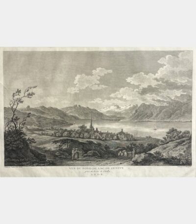
View of the bottom of Lake...
200 €View of the bottom of Lake Geneva from above Cueilly. Etching by Louis-Joseph Masquelier after Alexis-Nicolas Perignon. Circa 1780 – 1786.
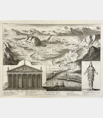
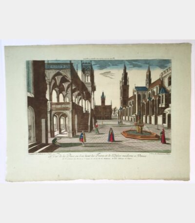
Map of the city of Ephesus...
100 €Plan of the city of Ephesus according to Pitton de Tournefort. Copper engraving. 1730.

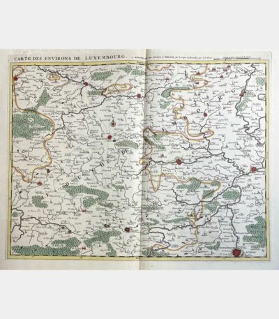
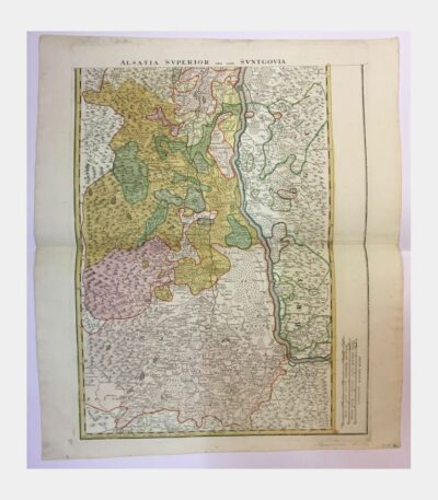
Map of the surroundings of Luxembourg
280 €Map of the Luxembourg area. Covens and Mortier. Eugène Henri Fricx. 18th century.
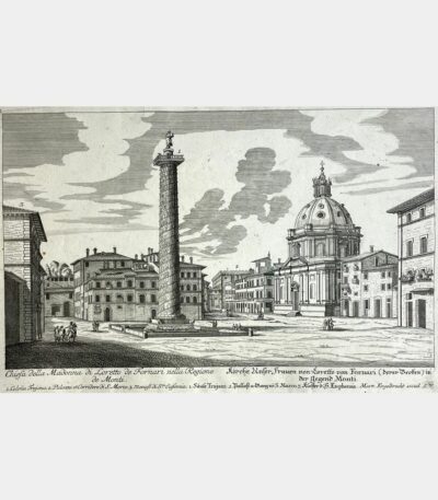
Chiesa della Madonna di Loretto di...
110 €Chiesa della Madonna di Loretto de Fornari nella Regione de Monti. Martin Engelbrecht. 18th century.
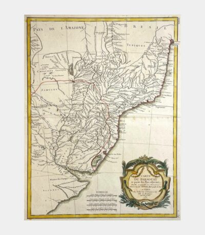
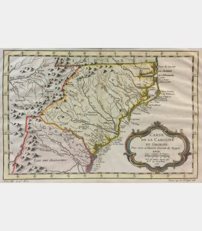
Map of Paraguay and adjacent countries
70 €Map of Paraguay and part of the adjacent countries. Rigobert Bonne. Copper engraving. 1782.
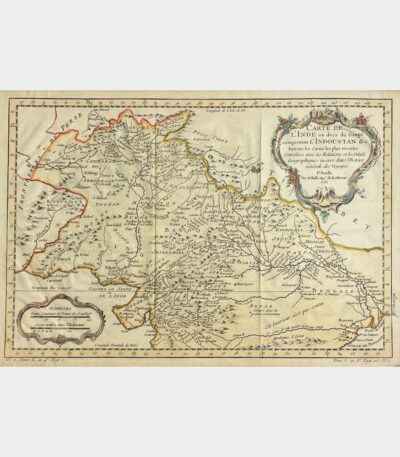
Map of India, below the Ganges...
75 €Carte de l’Inde, en deçà du Gange comprenant l’Indoustan. BELLIN (Jacques-Nicolas). 1752.
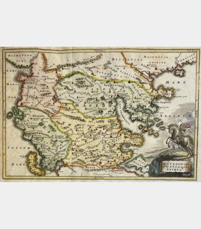
Macedonia, Thessalia, Epirus.
150 €Macedonia, Thessalia, Epirus. Christoph Cellarius. 18th century.
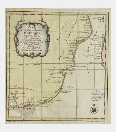
Carte de la Coste Orientale d’Afrique,...
65 €Carte de la Coste Orientale d’Afrique, Depuis le Cap de Bonne Esperance Jusqu’au Cap del Gada. BELLIN (Jacques-Nicolas). 18th century.
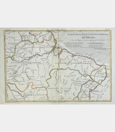
Northern part of the general government...
180 €Septentrional part of the general government of Burgundy. Gilles Robert de Vaugondy. 1748
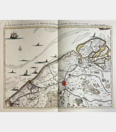
Particular map of the area around...
280 €Particular map of the area around Bruges, Ostend, Damme, L’Ecluse and others. Johannes Covens and Cornelis Mortier. 1745.
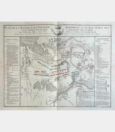
Plan of the battle of Fontenoy...
110 €Plan de la bataille de Fontenoy remportée le XI may M.DCC.XLV par l’armée françoise. Jean de Beaurain. 18th century.
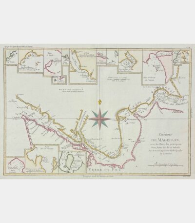
Strait of Magellan, with Plans of...
85 €Strait of Magellan, with the Plans of the principal Ports, Bayes of this Strait. Rigobert Bonne. 18th century.
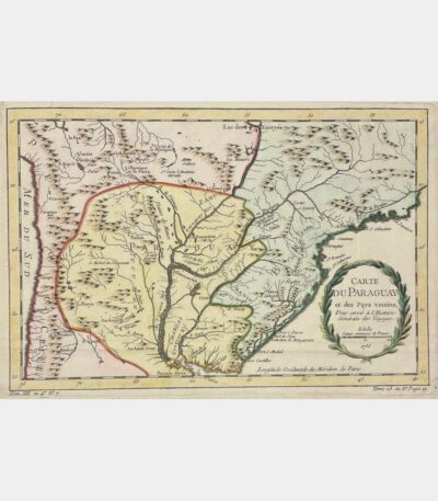
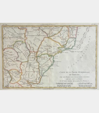
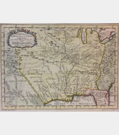
Map of Paraguay and neighbouring countries
70 €Map of Paraguay and neighboring countries. 18th century.
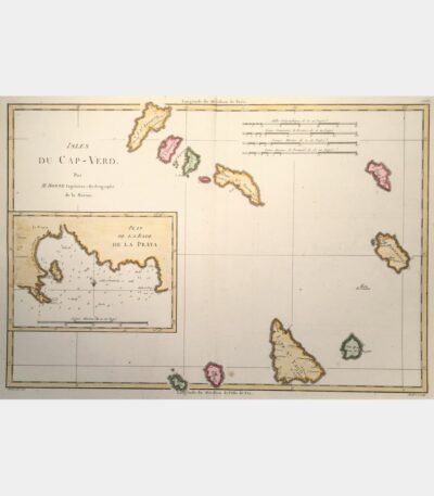
Cape Verde Islands. Plan of La...
90 €Cape Verde Islands. Plan of La Praya roadstead. Rigobert Bonne. 18th century.
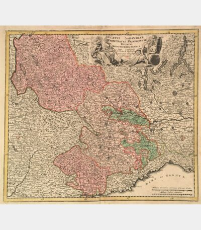
Ducatus Sabaudiae Principatus Pedemontii Ducatus Montisferratensis
150 €Ducatus Sabaudiae Principatus Pedemontii Ducatus Montisferratensis. Christoph Weigel. 18th century.
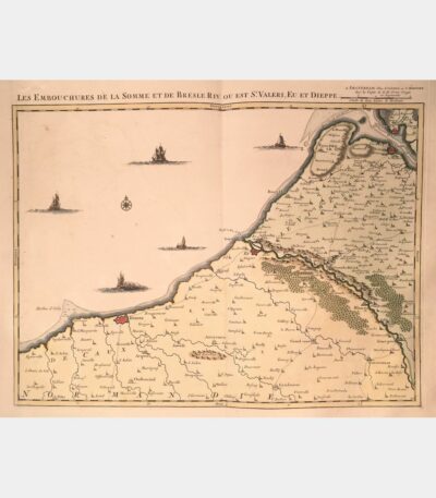
Mouths of the Somme and Bresle...
240 €The mouths of the Somme and Bresle Riv. or is St. Valeri, Eu and Dieppe. Amsterdam, J. Covens & C. Mortier. 18th century.
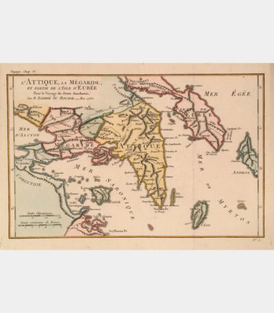
Attica, Megaraide and part of the...
55 €Attica, Megaraide, and part of the island of Evia. Jean-Denis Barbié du Bocage. 18th century.
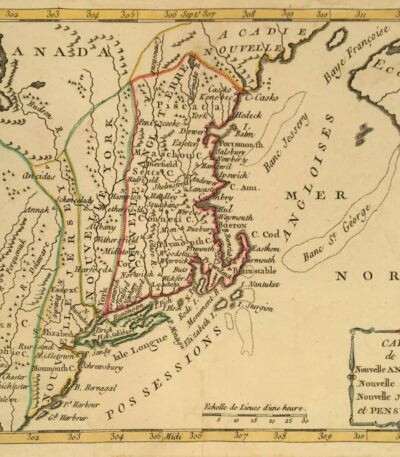
Map of New England, New York,...
110 €Map of New England, New York, New Jersey and Pensilvania. Joseph Delaporte. 1781.
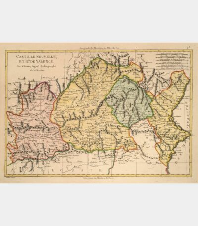
Castille Nouvelle et Royaume de Valence
70 €New Castile and Kingdom of Valencia. Rigobert Bonne. 18th century.
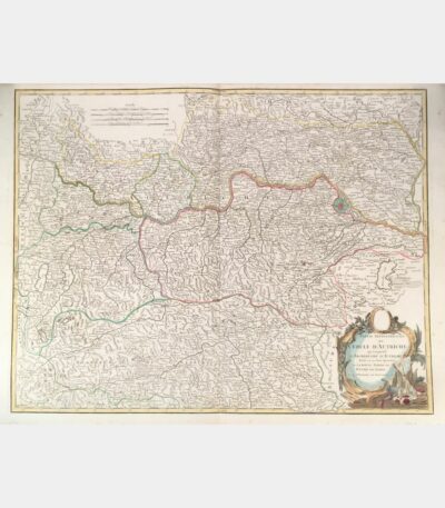
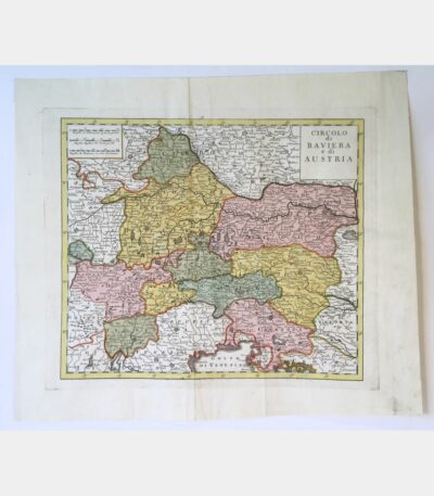
Northern part of the circle of...
120 €Northern part of the circle of Austria, comprising the Archduchy of Austria divided into its eight quarters and the upper part of the Duchy of Stiria. Didier Robert de Vaugondy. Circa 1800.
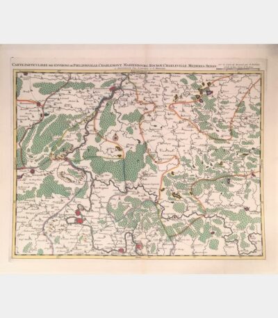
Special map of the area around...
180 €Special map of the area around Philippeville, Charlemont, Marienbourg, Rocroy, Charleville, Mezieres, Sedan. Covens (Johannes), Mortier (Cornelis). 18th century.
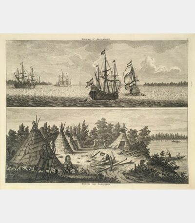
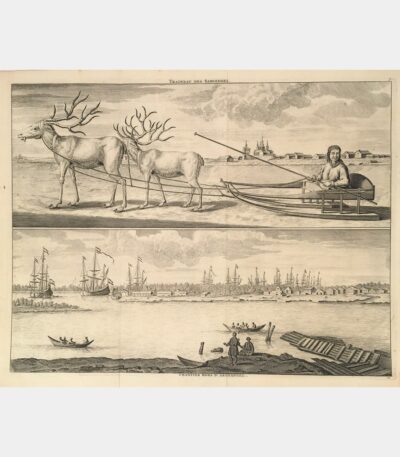
Samoiedes sleigh. Workcamps outside Archangel.
90 €Samoiedes sleigh. Shipyards outside Archangel. 1718.
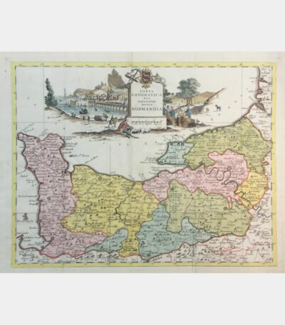
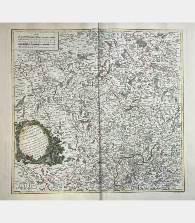
Carta geografica del governo della Normandia
160 €Carta geografica del governo della Normandia. De L’Isle (Guillaume). 1750.
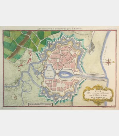
Plan Des Ouvrages Projettés pour la...
45 €Plan Des Ouvrages Projettés pour la Ville et le Port de Cherbourg. 18th century.
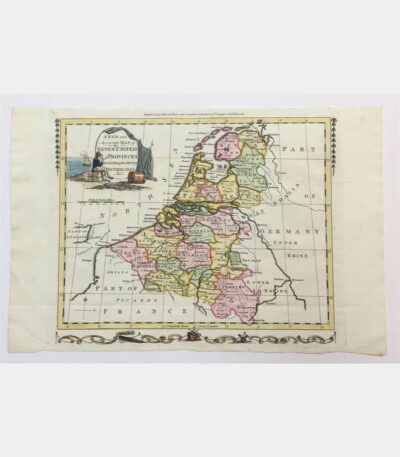
A new and accurate map of...
90 €Map of the Seven United Provinces. Copper engraving. 18th century.
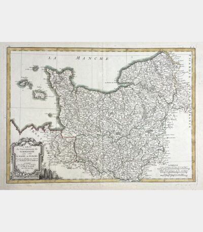
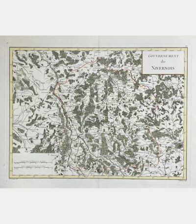
Map of the Government of Normandy...
Map of the Government of Normandy with that of Maine and Perche. Rigobert Bonne. 18th century.