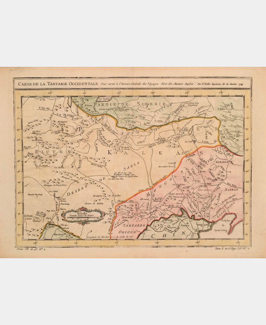
Map of Western Tartary
Map of Western Tartary. BELLIN (Jacques-Nicolas). 1749.
55 €
disponible
disponible
As far as possible, orders are dispatched within 48 hours of receipt of payment, at the latest within 7 days.
We apologize for any inconvenience this may cause during busy periods or in exceptional circumstances.
What should I do if I'm not happy with my purchase?
In distance selling, you benefit from a 14-day cooling-off period, if your purchase is not to your liking or does not conform to the description, shipping costs remain at your expense.
Your order is processed by L'image et le Livre as soon as online payment has been made and the order confirmed.
You will receive automatic confirmation that your order has been processed.
A shipping confirmation e-mail will be sent to you as soon as your parcel has been picked up by the transport and delivery company.
detailed information
Description
Carte de la Tartarie Occidentale Pour Servir à l’Histoire Générale des Voyages. Jacques-Nicolas Bellin (1703, Paris – 1772, Versailles) cartographer and hydrographer. 1757. Copper engraving. Hand-colored. Sheet size: 253 x 362 mm. Board size: 243 x 327 mm. Map showing the country of the Kalkas and the presumed site of Karakorum, seat of Genghis Khan’s empire. Very fine condition.

