France
Collection
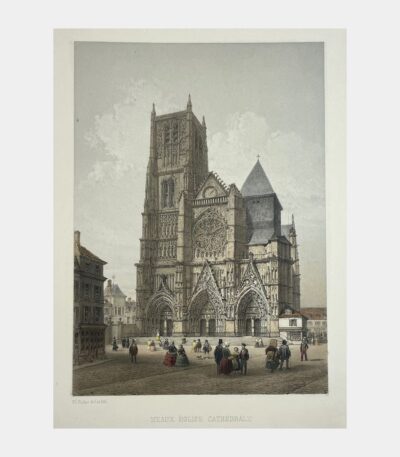
Meaux. Eglise Cathédrale.
120 €Meaux. Eglise Cathédrale. Lithographie en couleurs de Charles Fichot. 1858.
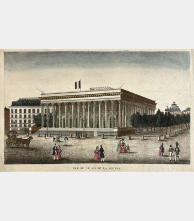
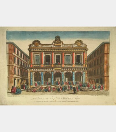
[Paris] Vue du Palais de la...
100 €[Paris] Vue du Palais de la Bourse. Gravure sur cuivre. XVIIIème siècle.
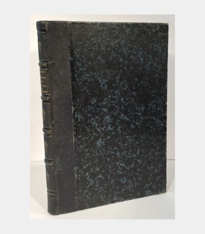
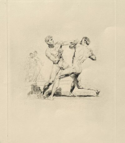
A walk through part of Savoie....
300 €A walk through part of Savoie. and on the shores of Lake Geneva, during the summer of 1839. VALGORGE (Ovide, de). 1847.
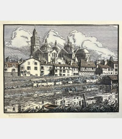
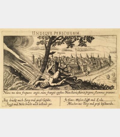
View of Strasbourg from Kehl
250 €View of Strasbourg from Kehl. Aquatint by Friedrich Salathé after Féderlé. 19th century.
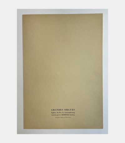
Grandes Orgues de l’église Saint-Pie X,...
35 €Grandes Orgues de l’église Saint-Pie, Luxembourg, built by E. A. Roethinger – Strasbourg. Robert Kuven (Strasbourg, 1901 – 1983, Strasbourg).
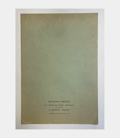
Grandes Orgues de l’église des Carmes,...
35 €Grandes Orgues de l’église des Carmes, Brussels, built by E. A. Roethinger – Strasbourg. Robert Kuven (Strasbourg, 1901 – 1983, Strasbourg). Original watercolor lithograph, signed. Sheet size: 400 x 270 mm. Fine proof in printed folder.
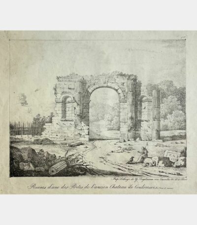
Ruins of one of the gates...
55 €Ruins of one of the gates of the old Château de Coulomiers (Seine et Marne). Lithograph by François-Alexandre Pernot. 1817.
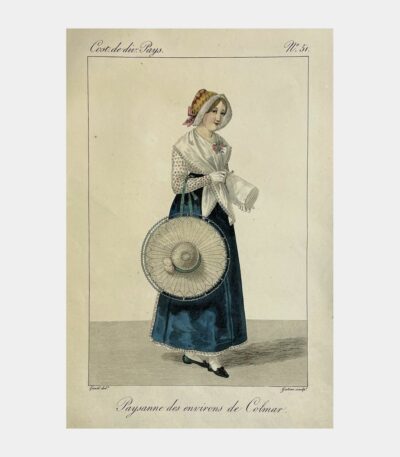
Peasant woman from the Colmar area
150 €Peasant woman near Colmar. Etching by Georges-Jacques Gatine after Louis-Marie Lanté. 1827.
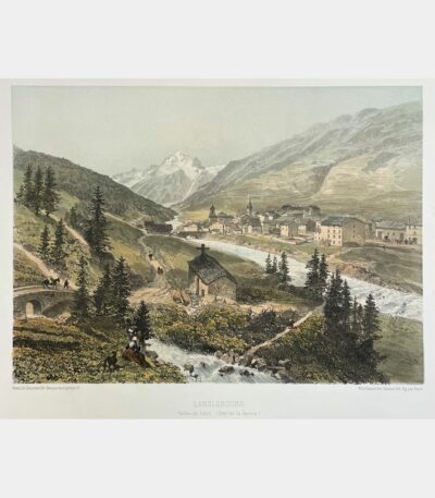
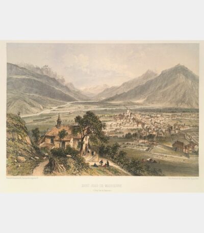
Lanslebourg. Arc Valley.
120 €Lanslebourg. Arc Valley. (Savoy Department). Lithograph by Sabatier. 1864.
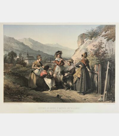
Costumes of Bourg Saint-Maurice
200 €Costumes of Bourg Saint-Maurice (Savoie department) and the Thonon area (Haute-Savoie department). Original color lithograph by Jules David. 1864.
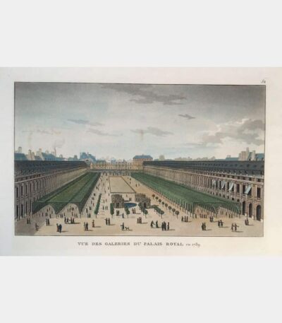
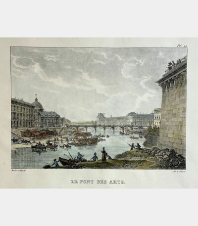
View of the Palais Royal galleries...
50 €View of the Palais Royal galleries in 1789. Aquatint. Nineteenth century.
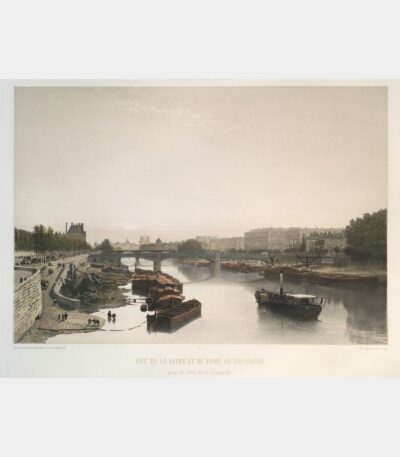
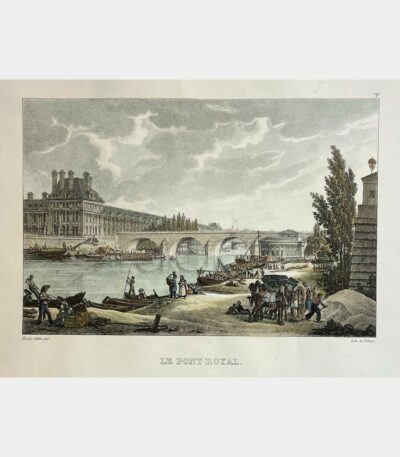
View of the Seine and the...
180 €View of the Seine and Solferino Bridge from the Pont de la Concorde. Original lithograph by Philippe Benoist. 1861
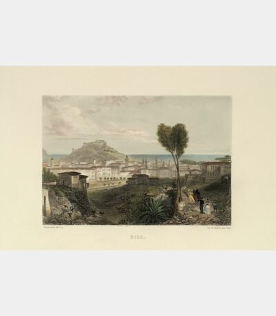
View of Sainte Croix and the...
80 €View of Sainte Croix and the Bouffay clock, Nantes. Lithograph by Motte. 19th century.
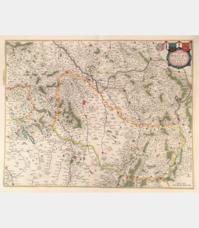
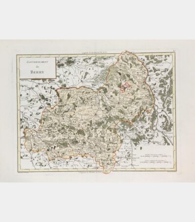
Diocese of Rheims and the country...
190 €Diocese of Rheims and the country of Rethel. Joan Blaeu. 1663.
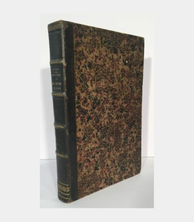
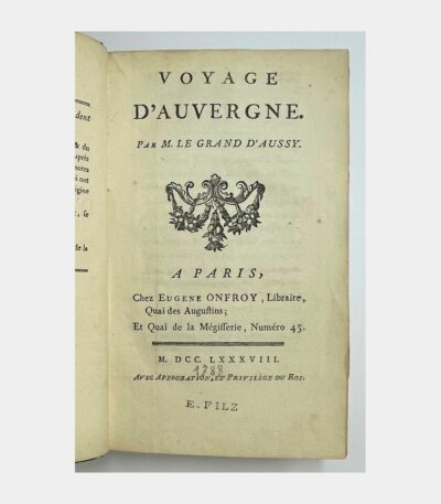
Topographical and medical history of the...
110 €Topographical and medical history of the Grand Hotel-Dieu of Lyon. Pointe (Jacques-Pierre). 1842.
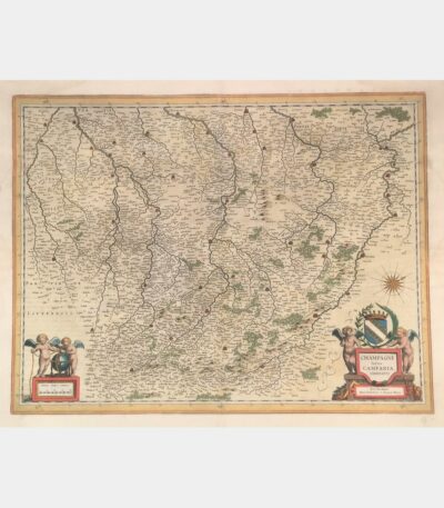
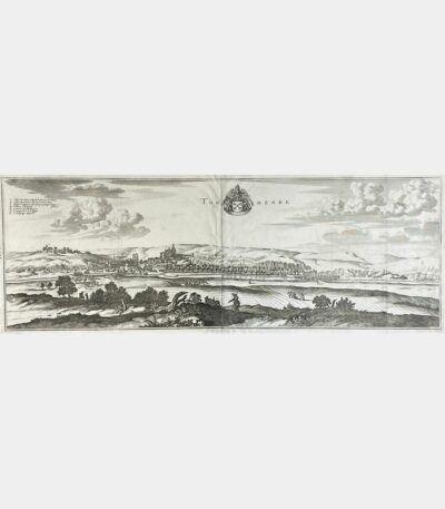
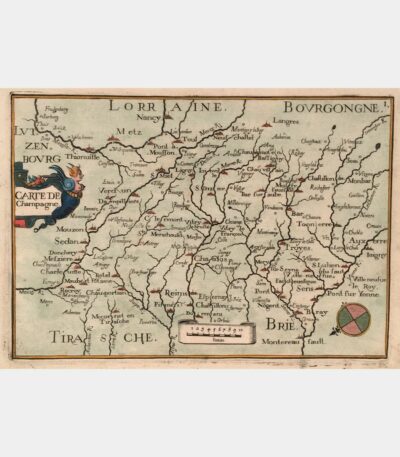
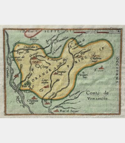
Latin Champagne Campania, Comitatus
180 €Latin Champagne Campania, Comitatus. Blaeu (Johann). 17th century.
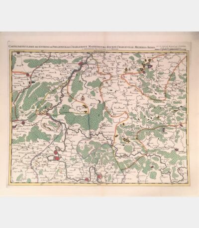
Special map of the area around...
180 €Special map of the area around Philippeville, Charlemont, Marienbourg, Rocroy, Charleville, Mezieres, Sedan. Covens (Johannes), Mortier (Cornelis). 18th century.
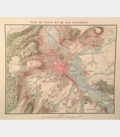
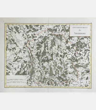
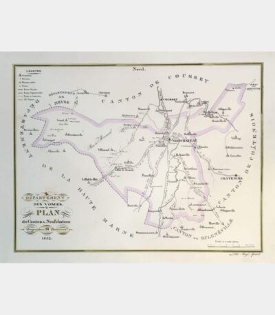
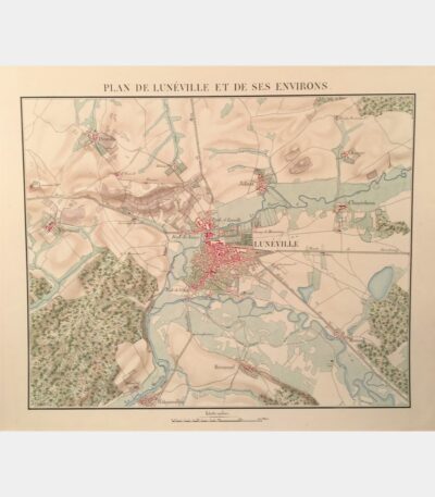
Map of Nancy and its surroundings....
800 €Nancy and the surrounding area. Manuscript map. Circa 1840.
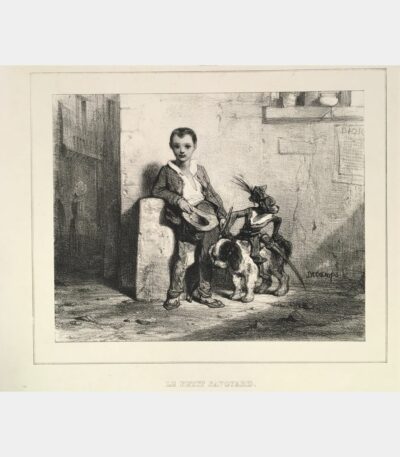
Le Petit Savoyard
60 €Le Petit Savoyard. Decamps (Gabriel Alexandre). Original lithograph. 19th century.
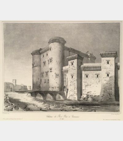
Château du Roi René in Tarascon
110 €Château du Roi René in Tarascon. Lithograph by Auguste Mathieu after Guesdon. 19th century.
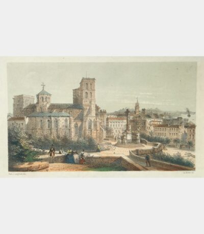
Notre-Dame-des-Doms, view from the Promenade du...
110 €Notre-Dame-des-Doms, view from the Promenade du Rocher (Avignon). Rivière (Ch.). 19th century
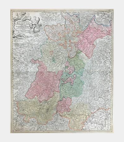
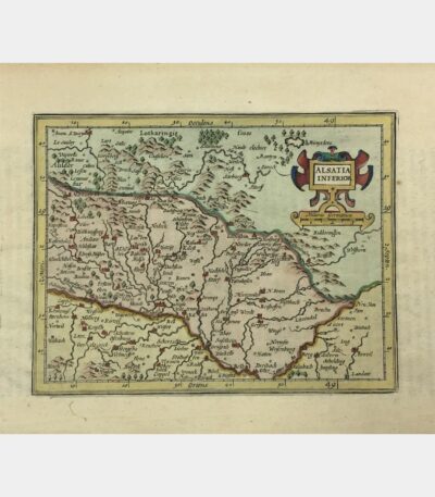
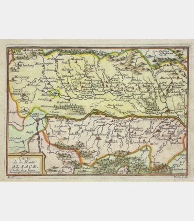
Landgraviatus Alsatiae tam Superioris quam Inferi(oris)...
230 €Landgraviatus Alsatiae tam Superioris quam Inferi(oris) cum utroque Marchionatu Badensi. 1720. Edited by Homann in Gutenberg. Copper engraving.
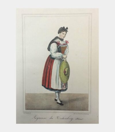
Paysanne du Kochersberg (Alsace)
160 €Peasant woman from Kochersberg (Alsace). Lithograph by Boehm after Charles Emerich.