Cartography and travel
Collection
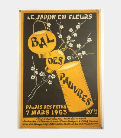
[Affiche] Le Japon en fleurs –...
[Affiche] Le Japon en fleurs – Bal des Pauvres. F. W. Dupret. 1953.
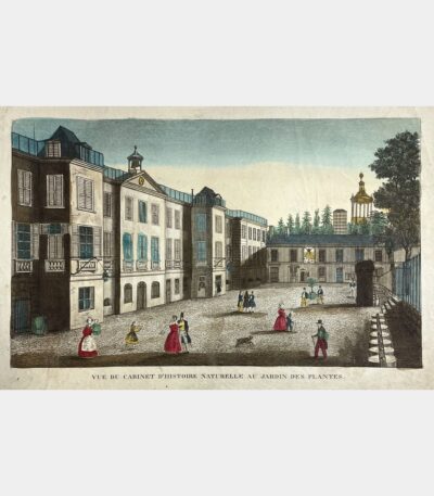
[Paris] Vue du Cabinet d’Histoire naturelle...
[Paris] Vue du Cabinet d’Histoire naturelle au Jardin des Plantes. Gravure sur cuivre. XVIIIème siècle.
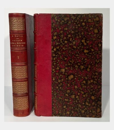
Diary of my third voyage of...
Diary of my third voyage of exploration in the Chinese Empire. DAVID (Armand, Abbé). 1875.
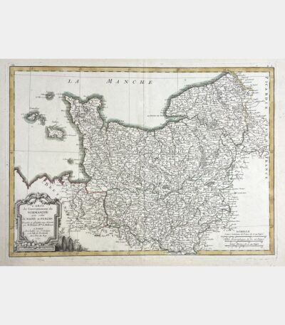
Map of the Government of Normandy...
Map of the Government of Normandy with that of Maine and Perche. Rigobert Bonne. 18th century.
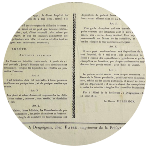
Sélestat. Brotherhood. Brotherhood letter.
Sélestat. Brotherhood. Brotherhood of the Purification of the Virgin. Johann Striedbeck. 18th century.
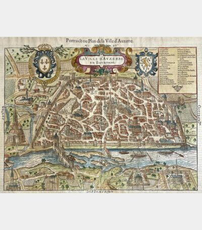
Portrait or Map of the City...
Portrait or Plan of the City of Auxerre. François de Belleforest. 1575.
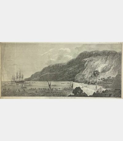
View of Karakakooa, part of Owhyhee...
View of Karakakooa, part of Owhyhee Island. 18th century.
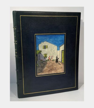
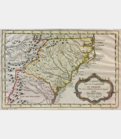
The Charentais landscape in the works...
The Charentais landscape in the works of Eugène Fromentin and Pierre Loti. Selected pages with commentary and illustrations by Louis Suire. Louis Suire. 1946.
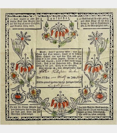
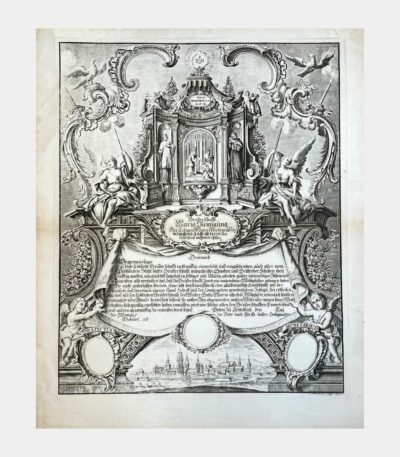
Christening wish – Tauf-Zedel (Taufzettel)
Christening wish – Tauf-Zedel (Taufzettel). Lingolsheim. 1809.
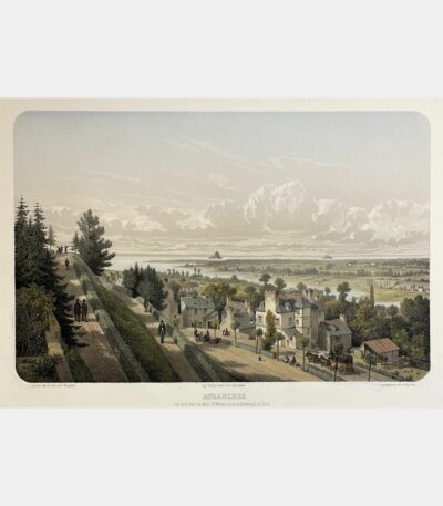
Avranches. View of the Bay of...
Avranches. View of the Bay of Mont-Saint-Michel, taken from Boulevard du Nord. Adolphe Maugendre. 19th century.
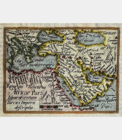
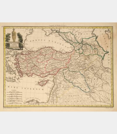
Turcici Imperii descriptio
Turcici Imperii descriptio. Ortelius (Abraham). 1583
Captain Bonneville’s travels and adventures in...
Captain Bonneville’s travels and adventures in the western United States of America, beyond the Rocky Mountains. Irving, Washington. 1837.
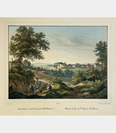
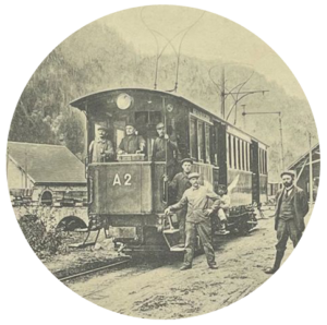
Railway from Saint-Louis to Mulhouse
Railway from Saint-Louis to Mulhouse. Lithograph by Rey after Wenterli. Circa 1850.
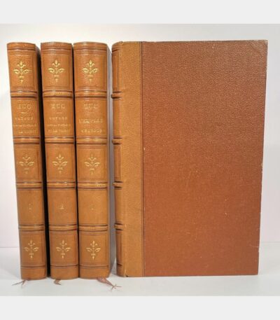
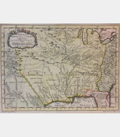
Souvenirs d’un voyage dans la Tartarie,...
Souvenirs d’un voyage dans la Tartarie, le Thibet et la Chine pendant les années 1844, 1845 et 1846 (followed by) L’Empire chinois. Huc (Evariste). 1853 – 1854.
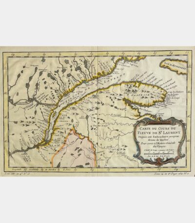
Carte du cours du fleuve Saint...
Carte du cours du fleuve Saint Laurent Depuis son Embouchure jusqu’au dessus de Quebec. Jacques-Nicolas Bellin. 1757.
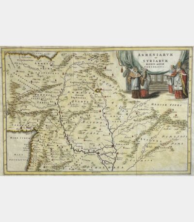
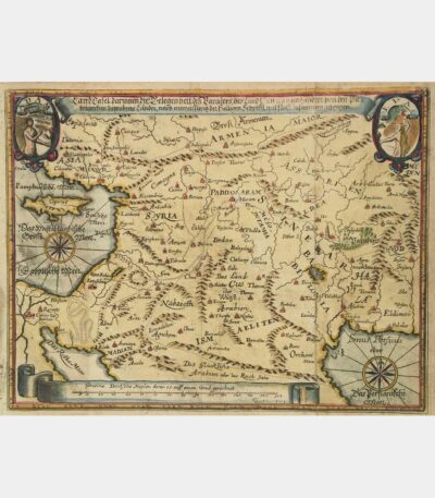
Armeniarum et Syriarum medio aevo conspectus.
Armeniarum et Syriarum medio aevo conspectus. Christoph Cellarius. 18th century.
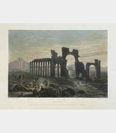
Palmyra. View of the triumphal arch,...
Palmyra. View of the triumphal arch, the great colonnade, a temple and the castle. William French after John Woodward. 1884.
Instituts politiques et militaires de Tamerlan,...
Political and military institutes of Tamerlane, properly called Timur. Langlès (Louis Mathieu). 1787.
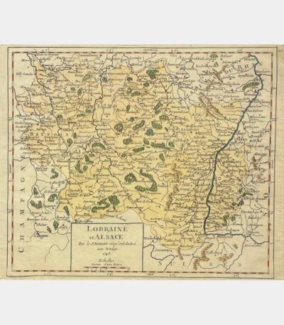
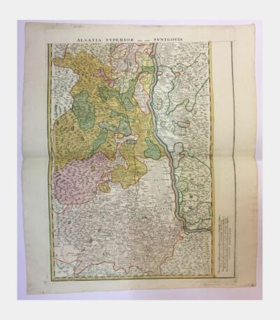
Lorraine and Alsace
Lorraine and Alsace. Gilles Robert de Vaugondy. 1748
Three views of Niederbronn and the...
Three views of Niederbronn and the surrounding area. View of the Niederbronn baths. The pond at Niederbronn. Ruin of the Wasenbourg. Anonymous. Nineteenth century.
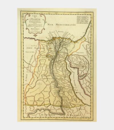
Map of Egypt to help understand...
Map of Egypt to serve the intelligence of Roman History. Liébaux (Henri). 1735.
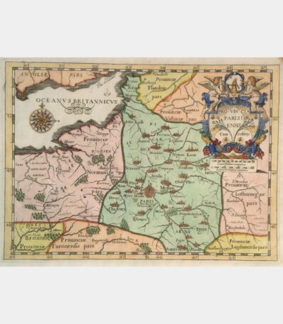
Provincia Parisiensis cum cofiniis
Provincia Parisiensis cum cofiniis. Copper engraving. 1654.

Constitution of England.
Constitution of England. [De Lolme (Jean-Louis)]. 1771.
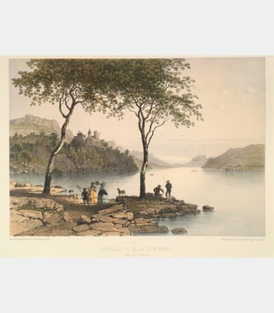
Châtillon and Lac du Bourget
Châtillon and Lac du Bourget. Lithograph by Eugène Ciceri. 1864.
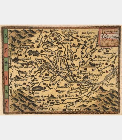
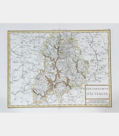
Limaniae Descriptio – map of Limagne,...
Limaniae Descriptio – map of Auvergne. Ortelius (Abraham). 1583
Asia Minor, Armenia, Caucasus, Syria, etc.
Asia Minor, Armenia, Caucasus, Syria, etc. Copper engraving. Early 19th century.
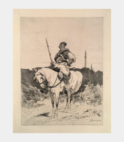
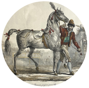
Serbian rider
Serbian rider. Charles Auguste Loye dit Montbard. 19th century.
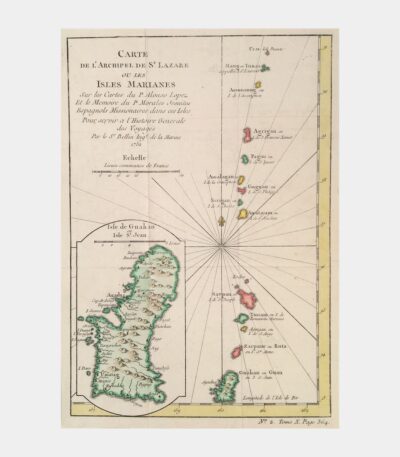
Map of the Archipelago of Saint...
Carte de l’Archipel de Saint-Lazare ou les Isles Marianes. Jacques-Nicolas Bellin. 18th century.
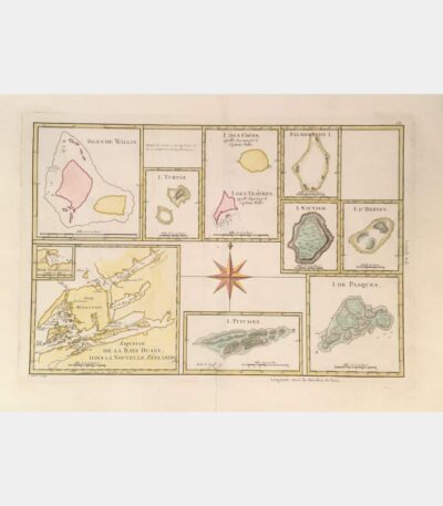
Wallis Islands. Sketch of the Baye...
Wallis Islands. Sketch of the Baye Dusky in New Zealand. I. de Pasques. Rigobert Bonne. 18th century.
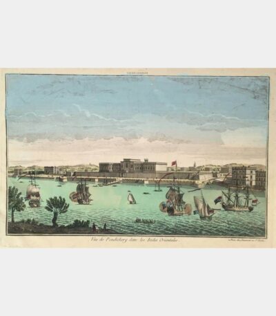
Vüe de Pondichery in the East...
Vüe de Pondichery in the East Indies. Optical view. 18th century.
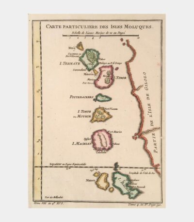
Special map of the Moluccan Islands
Particular map of the Moluccan Isles. Copper engraving. 18th century.
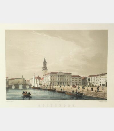
Gothenburg (Gustaf Adolfs Torg.)
Gothenburg (Gustaf Adolfs Torg.). Lithograph by A. Nay after C. Detloff. 1856.
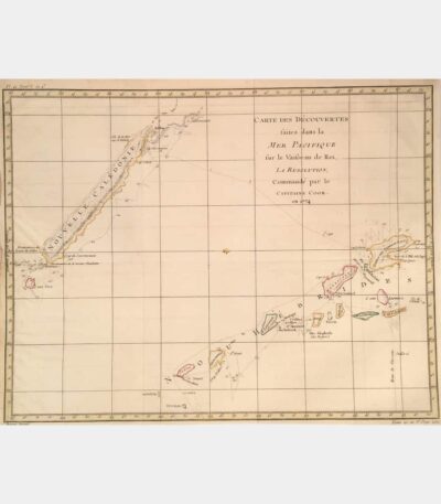
Carte des Découvertes faites dans la...
Carte des Découvertes faites dans la Mer Pacifique sur le Vaisseau de Roi, La Résolution, commanded by Captain Cook in 1774. Copper engraving. 18th century.
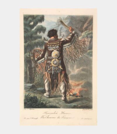
A Tungus Shaman
A Tungus Shaman. Aquatint by Pierre-Charles Coqueret after E. Karnejeff. Early 19th century.
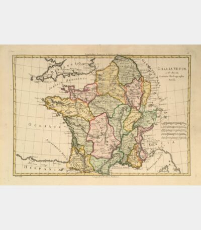
Map of France – Gallia Vetus
Map of France – Gallia Vetus. Bonne (Rigobert). 18th century.
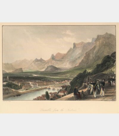
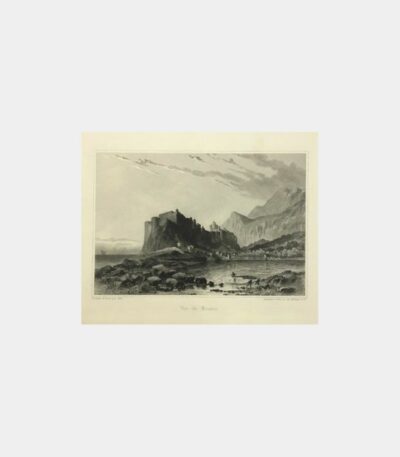
Grenoble from the Bastille
Grenoble from the Bastille. Steel engraving. 19th century.
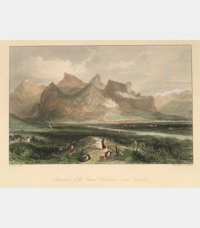
Grande Chartreuse mountain, from Grenoble
Grande Chartreuse mountain, from Grenoble. Steel engraving. 19th century.